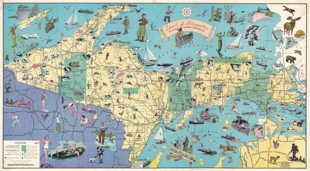
Land of Hiawatha Michigan's Upper Peninsula.: Geographicus Rare Antique Maps
1935 (dated) 1 : 700000 Description A rare and charming 1935 Frank Robert Harper pictorial map of the Upper Peninsula, Michigan. Coverage embraces the entire upper peninsula with adjacent parts of Wisconsin, Lower Peninsula Michigan, and Canada. Drawn in the style of pictorial mapmaker Ruth Taylor White, the map is rich with decorative vignettes illustrating the sporting and outdoor life available in the Upper Peninsula. The map was issued for the Upper Peninsula Development Bureau to promote tourism. Publication History and CensusThis map was copyrighted and issued in 193...
Source: geographicus.com